Posts

Showing posts from February, 2016

…Jerash and the end?
Image
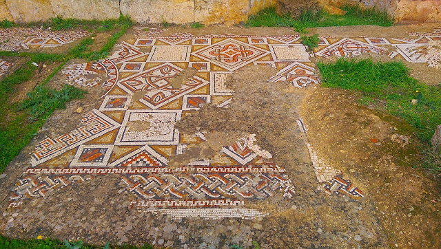
To complete the Traveler-tourist circuit, we had to visit Jerash. While we also wanted to drop into Ajloun, that wasn’t in the cards. There has to be some give and take on a circuit like this, and you also have to account for those unforeseen instances  so very common in fieldwork  (surprise meeting with the government concerning your research, for example). So off to Jerash we went, via a few backroads that afforded us fantastic views of the landscape surrounding Amman. More than a few times there were remarks about how European the physical landscape looked, noting that the barren-of-houses-yet-green-of-agriculture hillsides is actually how Amman proper looked before the population (refugee and immigrant) surges occurred. En route ,  we stopped for coffee (“Hot Strawberry” for me—like hot strawberry milk…yummy!) at a roadside petrol station called “Integrated Market”. True to its name, the place had snacks, drinks, paper towels, dish soap, mops, pliers, frozen foods...you name it.

...Amman proper and cooking...

Image
While conducting research in your home region can be tricky, conducting research in another country, while always tricky, can also be...complicated. Proposals to write, permissions to get, paperwork to complete...and it continues. This day began with a meeting at the Department of Antiquities to solidify research agendas. The support and interest is apparent, but the paperwork and waiting. Ugh. Lots of it. The good news? This allows plenty of time for fieldwork planning. The joys of fieldwork. After the morning meeting with the DOA, we headed out to the Citadel. I’ve written about it previously , and not going to repeat myself here, so there aren ’t any  pictures for this short blog. On this visit, however, we were able to visit the museum. Although the interpretive plaques are a bit yellowed and old, they still convey pertinent information and the museum’s layout and artifacts are crazy neat! And once you’ve seen pretty much all the places where those artifacts are from, it giv

...to the Eastern Desert...

Image
After a good night’s sleep, we had a leisurely morning and then headed out to the Eastern Desert for a quick castle loop. While there are a bunch of castles east of the north-south-running Desert Highway, we focused on three main ones, all along Highway 40: Kharana , Amra  (a UNESCO World Heritage Site), and Azraq . When you purchase an entrance ticket for 4JD, it also covers entrance to several other castles on the loop (Highways 40 and 30), so it’s quite the sight-seeing deal. The lesser-known & less-touristed desert castles are the focus of my personal research while here as a Fulbright Scholar, and I’ll post more about those explorations as they occur. Side note on the Eastern Desert Highways: Roadside mileage sign along Highway 40. Azraq (see below) is actually just 50 kilometers from the Saudi Arabian border. It's, umm...quite  exhilarating  to see a sign like this! The Eastern Desert Highways exist mainly for truckers transporting goods between I

A Mountain Road from the Dead Sea Highway to Amman

Image
After our final resort-and-explore day, we headed back to Amman via Mukawir and Madaba. As I mentioned in the previous blog, geomorphology in Jordan is fantastic. Folds, faults, hot springs, grabens, lava flows...the region is filled with textbook examples. The drive from the Dead Sea highway to Madaba via Mukawir (Highway 817) is quite the road. Go here , and look at the road just below the Balqua-Madaba Governates line (it should be the center of the map). That’s the road we drove—a zig-zagging road with a handful of 8% grades, but also a couple 15% grades. No typo. Fifteen-percent grades (I almost titled this entry “15%”). As we were driving up one of the steeper grades, my father-in-law said, “I can see why the King likes to ride motorcycles…this would be fun!” Indeed. It would be a great place to have a bike. We passed four or five cars on the entire road to Mukawir. A lonely, deserted, but well-maintained road. And in the center of it all, Ma’in hot springs resort with a hot,

...The Dead Sea Highway, Resorts, and Religion...

Image
One of the many ventifacts along the Dead See Highway. They are everywhere. Just take a look below at the short video clip... After a relaxing breakfast, we headed for the Dead Sea via the Wadi Araba. This route follows the “Dead Sea Highway”, which stretches from Aqaba in the south to almost the northern tip of Jordan. It also nearly-parallels the Jordanian-Israeli border. Heading out from Aqaba, the highway is pretty desolate for the first 150km or so. But, as a Geographer, there’s still much to see! Guard towers follow the route, Bedouin herders wander alongside the road with their animals, and the dark-colored desert pavement gives way here and there to deflation hollows and the occasional small erg (dune field). All the while, large alluvial fans and mountains of Jordan tower on your right side and the plains and hills of Israel & Palestine sit to your left. We spent some time looking for Jebel Haroun (Aaron’s tomb—of Old Testament fame) and scoured the desert pavement f

...in Wadi Rum, and then Aqaba...

Image
After two full days in Petra (and some sore legs from all the hiking), we headed to Wadi Rum after a leisurely breakfast. One of the few UNESCO natural and cultural sites, Wadi Rum represents an outstanding example of melding both: there are flora, fauna, and amazing geomorphology, coupled with not just historic Bedouin people and tribes, but also rock art (mainly petroglyphs) that span from Neolithic to contemporary times. Between Petra and Aqaba, and a short drive from the Desert Highway, Wadi Rum puts you smack in the middle of a place so foreign, that it has been used as the setting for the planet Mars in several movies ( The Martian , starring Matt Damon et al. was filmed here, as was Red Planet , starring Val Kilmer, et al., Lawrence of Arabia , and Transformers: Revenge of the Fallen are among the list). It’s not difficult to imagine being on the red planet when you’re in Wadi Rum. At first glance, Wadi Rum might seem familiar, especially for those who have visited the US

To Petra!

Image
Here begins the Traveler-tourist Circuit experiment. Each day or so another post will come online, detailing our experiences and a play-by-play of what we did. So... …on to Petra... After picking up our guests at the Amman airport, we drove back to the apartment for the night. We awoke early, leaving about 8:00am and taking a leisurely drive to Wadi Musa (the town at Petra’s gate). En route we drove on part of the King’s Highway, and attempted to visit Karak Castle. We found ourselves driving through a couple souks, and getting lost in the process. Very lost. We finally found a main road and, in the interest of time, decided to push on and explore Showbak Castle. Side note on “Highways” and signs: I use “Highway” in King’s Highway loosely. It’s not a very well-maintained road, but it follows the Roman Via Nova Triana , meaning it follows a pretty well-traveled route. Oddly, however, not many tourists take the road. Maybe even though it is a beautiful drive, people a